

Garmin Canada LakeVu G3 SD
-
The Advanced Freshwater Fishing Map
- Provides exceptional coverage, clarity and detail for more than 18,000 lakes with up to 1’ contours that feature integrated Garmin and Navionics® data
- Auto Guidance¹ technology uses your desired depth and overhead clearance to calculate routes and show a suggested path to follow
- Depth range shading for up to 10 depth ranges, enables you to view your target depth at a glance
- Shallow Water Shading allows for shading at a user-defined depth to give a clear picture of shallow areas
- Displays points of interest, campgrounds, highways and roads as well as underwater features such as riverbeds, fish attractors and potential hazards
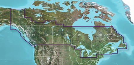
Experience unparalleled coverage and brilliant detail when you’re on the water. Canada LakeVü g3 inland maps provide industry-leading coverage, clarity and detail with updated inland maps that feature integrated Garmin and Navionics content.
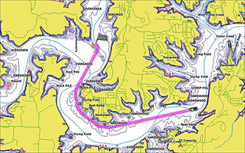
Auto Guidance Technology
The Auto Guidance feature¹ uses your desired depth and overhead clearance to calculate a route and suggest a path to follow.
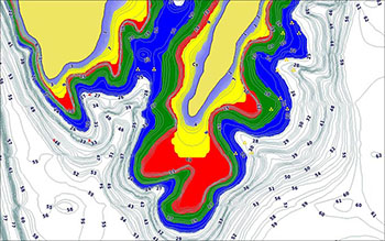
Depth Range Shading
This feature displays high-resolution depth range shading for up to 10 depth ranges so you can view your designated target depth.
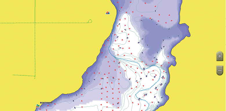
Shallow Water Shading
To give a clear picture of shallow waters to avoid, this feature allows for shading at a user-defined depth.
Access Your Charts and Maps
Download the ActiveCaptain app to use OneChart™, which gives you access to all your charts and maps from your mobile device and even lets you purchase new ones.
1Auto Guidance is for planning purposes only and does not replace safe navigation practices. Auto Guidance is not included in preloaded LakeVü g3 for ECHOMAP™ Plus series chartplotters
-
LakeVü Feature Comparison
Feature g3 Ultra g3 Navionics® data • • Total lakes covered 13,500+ 13,500+ Lakes with up to 1' contours 4,800+ 4,800+ Garmin Elite surveyed lakes Fish attractors Auto Guidance¹ technology • • High-resolution relief shading Depth range shading • • Shallow water shading • • Unique 3-D views • Dynamic lake level • High-resolution satellite imagery Surface and side scan sonar photos -
No reviews available.